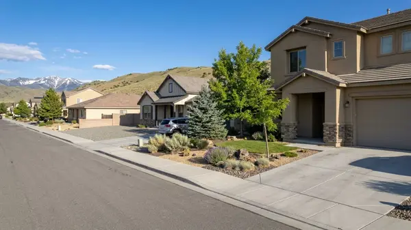
The History of South Reno, NV: From Ranchland to Master-Planned Suburbs
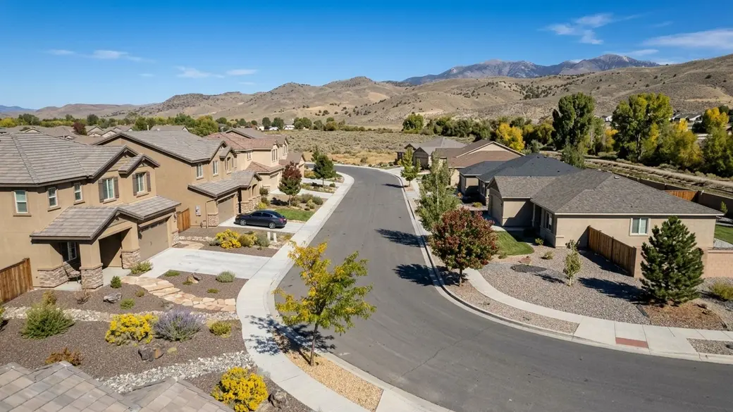
South Reno's shift from working ranchland to modern subdivisions happened over just a few decades, and it explains almost everything you'll encounter when you start shopping for a home here. The irrigation ditches and cattle operations didn't leave without a trace: they left easements, water rights questions, and lot patterns that still show up in title reports today.
That timeline shapes what kind of house, lot, and paperwork you'll encounter when you tour properties here.
Key Takeaway
South Reno grew from ranches, irrigation ditches, and the Steamboat hot springs into master-planned subdivisions, which is why single-family houses made up 210 of the 244 sales in the 90 days ending September 30, 2026. If you want a detached home in a planned community, start with the former ranch lands of Damonte Ranch and Double Diamond. If you want a lower entry price, the small condo market is the alternative, though it moves more slowly.
Who This Guide Is For
You're considering a home in South Reno and want to know how the area was built, so you know what kind of house, lot, and paperwork to expect before you shortlist properties.
How South Reno Grew from Ranchland
South Reno is an informal name for the southern part of the Truckee Meadows, roughly along the I-580 and US 395 corridor toward the Mount Rose Highway. The City of Reno uses six City Council wards, each with roughly 43,000 to 45,000 residents under boundaries that took effect in 2024. The city's official ward map doesn't separately delineate South Reno as a named planning area distinct from the numbered wards.
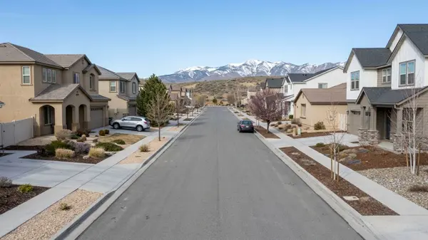
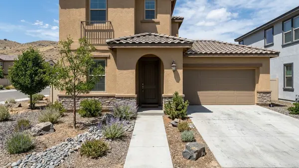
That history as ranch and hot-springs country, later subdivided into master-planned communities, is what shaped the housing stock you're looking at now. Single-family houses made up 210 of the 244 South Reno sales in the 90 days ending September 30, 2026. The few condos that sold took a median 93 days versus 55 for houses, based on 23 condo sales.
Parts of the area were annexed into the City of Reno over time, while other parcels remain in unincorporated Washoe County. The South Meadows area was developed under a Planned Unit Development originally approved by the city in 1995. Which era built a street tells you what kind of home and paperwork to expect, and you can compare property types in our guide to buying a home in South Reno.
South Reno History Timeline
The Washoe Tribe of Nevada and California refers to the Truckee Meadows area as "Welganuk" in their own language, reflecting its place within their ancestral homeland. The tribe organized its modern government in 1934 and adopted its constitution in 1937.
By the mid-1800s, Comstock-era travel brought attention to the Steamboat Hot Springs along Steamboat Creek. The mineral spas became a known stop, and the site is now marked by Nevada Historical Marker 198 along the Carson-Reno Highway.
The Virginia & Truckee Railroad reached Steamboat Springs from Reno in 1871. The stop briefly served as a temporary rail terminus and transfer point for stagecoaches bound for Virginia City until the tracks extended south to Carson City the following year.
Agricultural use expanded with the completion of the Steamboat Ditch in 1880, a roughly 30-mile irrigation canal that ran from the Truckee River through North Reno down to Steamboat Creek, built to provide irrigation water and flood mitigation for the area's farmlands.
Suburban commercial growth arrived in 1978 with the opening of Meadowood Mall, a super-regional enclosed mall anchored by JCPenney, Liberty House, and Macy's. Soon after, developers began turning the large ranches south of the mall into master-planned communities.
Double Diamond Ranch was built on a former 2,600-acre ranch in the South Meadows area after developers secured a map revision from FEMA and signed a 1996 maintenance agreement with the City of Reno. The region's modern infrastructure was completed in August 2012 when the Galena Creek Bridge opened, finishing the I-580 freeway extension between Reno and Carson City.
How South Reno's Past Shapes Today's Homes
The transition from large ranches to planned subdivisions created a housing market weighted toward detached homes. Buyers choosing between a house and an attached unit will find very different inventory levels and very different negotiating conditions.
Single-Family Houses
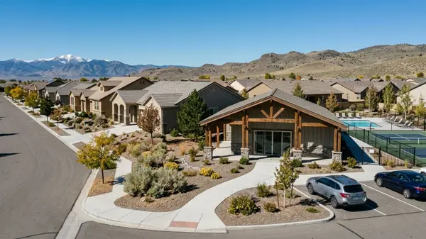
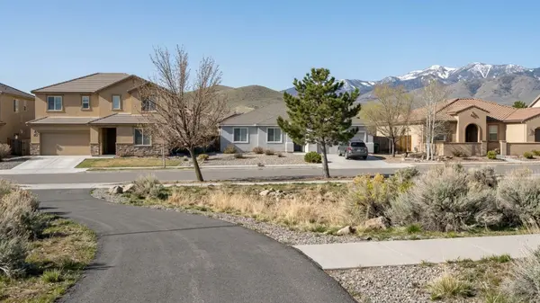
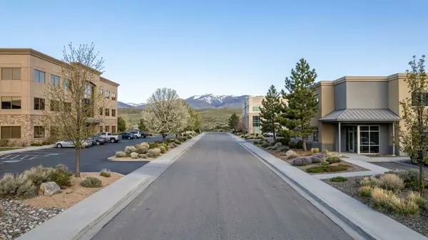
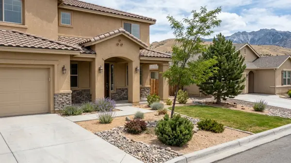
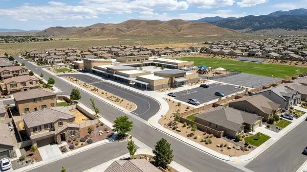
Planned communities on former ranch land form the bulk of the market, with newer construction and consistent lot patterns throughout. Damonte Ranch and Double Diamond are two examples of former ranches that became large residential footprints.
Houses here commanded a median $768,931 over the 90 days ending September 30, 2026, with 14.6% selling above list. A well-priced home can draw competing offers. Have your financing sorted before you start touring, and you can check current prices by area in our guide to South Reno neighborhoods.
Master-planned communities almost always come with HOA dues and CC&Rs that govern what you can change about the property. Ask the HOA for current dues, the reserve study, and the CC&Rs before you commit, as they vary by community and can't be assumed.
Condos and Townhouses
Because developers built the area primarily for detached homes, attached housing is a small slice of the market. Only 23 condos sold across all of South Reno in the 90 days ending September 30, 2026, and with only 4.5% selling above list, buyers typically have room to negotiate on price or terms.
The condo median sat at $453,987, a lower entry point than houses, though buyers should prepare for the slower pace noted above. You can track these shifts on our South Reno housing market trends page.
With so few attached sales, resale will take longer than it would for a house. Ask the HOA about FHA approval status and any pending special assessments before you go under contract.
What South Reno's History Leaves in a Title Report
Each historical layer of development leaves specific details in a property's disclosures or title commitment, and it pays to know what you're looking for before you open escrow.
Ranch-era irrigation infrastructure means some parcels come with ditch easements or questions about water rights. Ask the title officer for all recorded easements on the parcel and whether any water rights transfer with the property. Older rural parcels outside the planned communities, particularly those near the Steamboat area, might rely on private utilities rather than city connections. Confirm whether the home is on city water and sewer or on a private well and septic using the seller's disclosures and Washoe County records.
Master plans brought homeowners associations and restrictive covenants to the newer subdivisions, so request the full resale package during escrow. Parcels may fall inside the City of Reno or sit in unincorporated Washoe County: use the Washoe County Assessor parcel search to confirm which jurisdiction governs the address.
Geography also dictates which property documents you receive. Homes near the foothills sit in wildland-urban interface areas, and lots near Steamboat Creek may sit near mapped flood zones. Look up the address on the FEMA Flood Map Service Center and check wildfire risk and defensible-space guidance with the Truckee Meadows Fire Protection District.
Your title officer or attorney interprets these documents during the transaction. The Berman Group can help a buyer gather these records for a specific South Reno address.
Where to See South Reno History Today
Bartley Ranch Regional Park preserves a piece of the area's agricultural past. Originally part of the historic Wheeler Estate and later a horse boarding and training facility after World War II, the property was sold to Washoe County in 1985. The park opened in 1995 and now houses the Western Heritage Interpretive Center.
The Steamboat hot springs area remains active, continuing a legacy of mineral spas that dates to the mid-1800s. The site sits along South Virginia Street and is listed on the Nevada State Register of Historic Places.
Drivers can trace the historic route toward Lake Tahoe via the Mount Rose Highway, originally designated State Route 27 by 1941 and renumbered to SR 431 in 1976. The road crosses Mount Rose Summit, with roughly 20 miles of it designated as a Nevada Scenic Byway. The Nevada Historical Society in Reno holds additional archives and exhibits for those looking to research the region further.
How to Use South Reno's History When You Shop
Your first decision is whether you need a detached house or whether a condo or townhouse works for your budget. Houses dominate the market; attached homes are few and slower to sell, as covered in the housing section above.
Next, decide whether you want a newer master-planned community with an HOA or an older parcel that may come with a well, septic system, or ditch rights. If a home near the hills or along Steamboat Creek is on your list, run the flood and wildfire checks from the title section before you tour, not after.
If you want a detached house in a newer planned community, start with the former ranch lands of Damonte Ranch and Double Diamond. If you want the lowest entry price and room to negotiate, look at South Reno condos. For more land and a pre-master-plan setting, consider older rural parcels near the Steamboat area.
You can weigh the lifestyle fit in our guide to the pros and cons of living in South Reno. When you're ready to start touring, we can help you choose a buyer's agent in South Reno.
South Reno at a Glance
- All homes, 90 days ending 2026-09-30: median sale price $729,786, up 6.5% year over year, from 244 sales
- All homes, 90 days ending 2026-09-30: median 56 days on market, 98.8% sale-to-list, 13.4% sold above list
- All homes, 90 days ending 2026-09-30: 2.5 months of supply, 197 homes for sale, median $354 per sq ft
- Single family, 90 days ending 2026-09-30: median sale price $768,931, up 8.1% year over year, from 210 sales, median $365 per sq ft
- Single family, 90 days ending 2026-09-30: median 55 days on market, 99% sale-to-list, 14.6% sold above list, 2.5 months of supply, 170 for sale
- Condo, 90 days ending 2026-09-30 (based on 23 condo sales, a small sample): median sale price $453,987, up 8.6% year over year, median $307 per sq ft
- Condo, 90 days ending 2026-09-30 (based on 23 condo sales): median 93 days on market, 98.2% sale-to-list, 4.5% sold above list, 2.1 months of supply, 16 for sale
- Townhouse, 90 days ending 2026-09-30 (based on 11 townhouse sales, treat as directional): median sale price $500,001, up 1.1% year over year, median $289 per sq ft, 55 days on market, 97.8% sale-to-list, 9.1% sold above list, 3.2 months of supply, 12 for sale
You can review the latest market shifts on our South Reno housing market trends page.
South Reno History FAQs
What Is Considered South Reno?
South Reno is an informal name, so real estate listings and maps may draw the boundaries differently depending on the source. Because the city's official ward map divides Reno into six numbered council wards rather than named neighborhood planning areas, no formal boundary separates South Reno from the rest of the city.
Is South Reno in Southern Nevada?
No, South Reno is not in southern Nevada. It's the southern portion of the City of Reno, located in Washoe County in northern Nevada. Southern Nevada refers to the Las Vegas area in Clark County.
What County Is South Reno in, and Is It Part of the City of Reno?
South Reno is in Washoe County, and much of it has been annexed into the City of Reno over the years, including the South Meadows area under a Planned Unit Development approved in 1995. You can confirm a specific parcel's jurisdiction using the Washoe County Assessor parcel search.
Is Southwest Reno the Same as South Reno?
Southwest Reno and South Reno are generally treated as different areas by locals, though the city's official map doesn't draw a formal line between them. Because listing labels can differ from city maps, buyers should confirm the location by address.
Has South Reno Had Major Wildfires?
Yes. The Washoe Drive Fire burned through the nearby Washoe Valley and Pleasant Valley areas in January 2012. Official reports indicate the fire destroyed 29 homes and burned roughly 3,900 acres before being contained. Buyers should check current fire information and defensible-space guidance with the Truckee Meadows Fire Protection District.
Is South Reno Safe?
Crime data for City of Reno addresses is managed by the Reno Police Department, which links to the FBI Crime Data Explorer for public reports. Unincorporated parcels fall under the Washoe County Sheriff's Office, which provides maps for firearms discharge restrictions and jointly operates a sex offender registry portal. Neither department advertises a single general-crime incident map, so residents should contact the respective agencies for specific address inquiries.
What Is South Reno Known For?
South Reno is known for its large master-planned communities built on former ranch lands. It's also recognized for the historic Steamboat hot springs and the Mount Rose Highway, a Nevada Scenic Byway that serves as the main route toward Lake Tahoe.
Sources
- Redfin: Data Center
- The Barber Brief: Spotlight on the Reno Planning Commission
- Washoe Tribe: Chronology
- Nevada State Historic Preservation Office: Listed Properties
- Wikipedia: Steamboat Springs, Nevada
- University of Nevada, Reno: Steamboat Ditch
- FindLaw: Double Diamond Ranch Case
- Washoe County: Bartley Ranch Regional Park
- Wikipedia: Meadowood Mall
- Wikipedia: Interstate 580 (Nevada)
- Wikipedia: Washoe Drive Fire
- Wikipedia: Nevada State Route 431
- City of Reno: Police Resources
- City of Reno: Ward Map
Categories
Recent Posts