Getting Around South Reno, NV: Roads, Buses, Commutes, and Winter Driving
No ranking page treats getting around South Reno as a housing decision, but the local geography makes it one.
Key Takeaway
Plan on owning a car. South Reno is organized around I-580 and South Virginia Street, and RTC buses mostly run the Virginia corridor. The best move is to buy near an I-580 interchange on the side of town you drive toward most. If that location stretches your budget, condos are the lower-cost, more negotiable alternative.
Who This Guide Is For
You are weighing a move to South Reno and want to know how commutes, errands, and winter driving will work before you decide which part of it to buy in.
How Getting Around South Reno Works
The part of South Reno you buy in decides how long your daily trips take, how much winter driving you face, and whether a bus is realistic. Buyers comparing neighborhoods often review the pros and cons of living in South Reno.
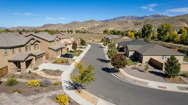
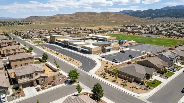
South Reno is generally associated with ZIP codes 89511 and 89521, with some overview sources also including 89502. ZIP 89511 covers the Galena foothills area in southeast Reno, including ArrowCreek, Montreux, Galena, and the Mount Rose Highway corridor. ZIP 89521 covers the valley-floor areas of southeast Reno, including Damonte Ranch, South Meadows, and Double Diamond along the Veterans Parkway and I-580 corridor.
Traffic funnels onto three kinds of road: the freeway for distance, one commercial street for local stops, and a handful of parkways linking neighborhoods to both.
I-580 Is the Main Route North and South
The freeway is the backbone to downtown, the airport, Sparks via I-80, and Carson City. Being near an interchange matters more than your straight-line distance to a destination. Northbound merges toward Moana and Meadowood back up at rush hour.
South Virginia Street Is the Local Main Road
Grocery stores, retail centers, and medical offices sit along this route, and it carries the main bus corridor. Signals and turning traffic make it slow for anything beyond a few miles. Living near South Virginia Street helps with daily errands but not with a cross-town commute.
The Parkways That Connect Neighborhoods to the Freeway
South Meadows Parkway, Damonte Ranch Parkway, Steamboat Parkway, Mount Rose Highway (SR-431), Arrowcreek Parkway, and Veterans Parkway are the east-west links. Which one serves a home largely sets its drive time.
There are few east-west connectors, so each one concentrates traffic at school drop-off and shift-change times. Drive the connector and your actual commute from a listing at 7:30 a.m. and 5:00 p.m. before making an offer.
Drive Times from South Reno
Because South Reno stretches for miles, the time to reach each destination below comes down to how far south you live and how close you are to an interchange. It also varies with weather and traffic.
Downtown Reno
This is a straight I-580 run north. The time difference between the north end of South Reno and the far south end is noticeable on a daily basis. Downtown event nights and the I-80 interchange add unpredictable minutes. If you'll commute there daily, check downtown parking costs and availability.
Reno-Tahoe International Airport
The airport sits north along the same I-580 corridor, which makes South Reno one of the closer residential areas to flights. There's no direct bus link from South Reno to the airport. Check the RTC system map for a one-seat ride from a specific address, or budget for rideshare and parking.
Carson City
The state capital and its jobs are a southbound I-580 drive through Washoe Valley, so the south end of South Reno has a real advantage for this commute.
Washoe Valley wind can slow or restrict travel on I-580. NDOT's wind-warning system automatically posts restrictions prohibiting vehicles 9 feet or taller when gusts reach about 50 mph in Washoe Valley, or over 35 to 40 mph between Mt. Rose Highway and north Washoe Valley. A Carson City commute has bad-weather days.
Lake Tahoe and Incline Village
Mount Rose Highway (SR-431) starts in South Reno and climbs to Incline Village, so Tahoe is closer from here than from most of Reno. The road crests Mount Rose Summit at 8,911 feet, the highest mountain pass in the Sierra Nevada that NDOT keeps open year-round. In winter, trips depend on the chain controls covered below.
Sparks and the Tahoe Reno Industrial Center
Warehouse and manufacturing jobs east on I-80 mean crossing the whole metro, taking I-580 north to I-80 east. This is the longest daily commute on the list, and it runs through the busiest interchange in the region. If this is your job location, the drive time may outweigh every other housing factor.
Sacramento and the Bay Area
Trips to Northern California take I-80 west over Donner Summit. Winter storms bring chain controls and closures there, so a winter drive can take far longer than usual. Check Caltrans and NV Roads before you leave.
Public Transportation in South Reno
RTC Washoe runs the local buses. Whether one works for you depends on the stop nearest your address and how often it's served.
RTC Bus Routes Along South Virginia Street
South Reno is served primarily by Route 1 (S Virginia St) and the RTC RAPID Virginia Line. The RAPID Virginia Line's southern terminus is the RTC Transfer Center at Meadowood Mall in South Reno. Local South Reno routes, like Route 56 for South Meadows and Damonte Ranch, also originate from the Meadowood Mall Transfer Facility.
Coverage thins fast away from South Virginia Street, and most foothill and east-side subdivisions are a long walk from any stop. Find the nearest RTC stop to the address and check its weekday and weekend frequency on RTC's system map.
Bus Fares and Passes
RTC RIDE and Regional Connector single rides are $2.00 regular and $1.00 reduced, or 75 cents for disabled/ACCESS ID riders. A 31-Day Pass is $65.00 regular and $32.50 reduced. Children 5 and under ride free with an adult. Confirm current pricing on RTC's site before building transit into a household budget.
RTC Regional Connector to Carson City
The RTC Regional Connector Carson Express runs weekdays between RTC 4th Street Station in downtown Reno and the Nevada DOT stop in Carson City. Key stops include the RTC Transfer Center at Meadowood Mall and Herz Boulevard at Mt Rose Highway. Weekday outbound departures from Reno run at 5:47 a.m., 6:17 a.m., 6:47 a.m., 3:05 p.m., 4:05 p.m., and 5:30 p.m.
Trips run only at those set weekday times. Missing the last run means finding another way home.
Park-and-Ride Lots
RTC Washoe operates park-and-ride lots for commuters. Check current locations on its website. From some South Reno homes, the drive to a lot costs more time than it saves.
Paratransit and Senior Rides
RTC ACCESS is the ADA paratransit service for riders who cannot independently use standard buses. The Washoe Senior Ride program, funded by Washoe County sales tax, provides subsidized transportation to Washoe County residents age 60 and older, any-age RTC ACCESS clients, and Washoe County veterans of any age.
Paratransit generally follows fixed-route coverage and requires eligibility approval and advance booking. A home far from the bus corridor may be outside convenient paratransit service. If transit access may matter later, confirm whether the address is in the RTC ACCESS service area.
Rideshare, Biking, and Walking in South Reno
Alternatives to driving yourself drop off sharply once you leave the flat valley floor.
Rideshare and Taxis
Uber, Lyft, and taxis work well for airport runs and nights out along the commercial corridor. Wait times stretch in the foothills and late at night. Open rideshare apps at the times you would need a ride from the address to gauge actual waits.
Biking in South Reno
Bike lanes and multi-use paths run along some of the main parkways, and a bike trip to South Virginia Street shopping is realistic from the valley floor. Foothill homes mean a steep ride back up. Wide arterial crossings and winter conditions limit year-round bike commuting for most residents.
Where Walking Works
Walking is practical in pockets where homes sit next to shopping centers and medical offices along South Virginia Street and the main parkways. Elsewhere, it's mostly recreational. Subdivisions are often separated from stores by arterials and walls, so a store that looks close on a map can be a long walk. Walk the real route from a listing to the nearest grocery store.
Winter Driving and Road Conditions in South Reno
Elevation and slope decide how long snow stays on a street, and municipal boundaries decide who plows it.
Snow and Ice on Foothill Streets
Higher, sloped streets west and south of the valley floor hold snow and ice longer than flat valley streets. Within Reno city limits, the City of Reno's Public Works Department prioritizes major arterials and collectors. In unincorporated Washoe County areas, the county handles snow removal separately and maintains its own map for routes not covered by the city.
Residential side streets are usually low on plow priority, and private HOA roads rely on contractors. Check whether the street is maintained by the City of Reno, Washoe County, or an HOA, and ask who plows and how quickly. Look at driveway slope and which way it faces, since north-facing slopes hold ice longer.
Chain Controls on Mount Rose Highway
NDOT periodically imposes winter chain controls on SR-431 during storms. Check NV Roads (nvroads.com) before winter trips on Mount Rose Highway or I-80. During heavy storms, the highway can close entirely. That cuts off the quickest Tahoe route and, for homes along it, the main road out.
Road Construction to Watch
As of fall 2026, RTC Washoe's Virginia Line BRT Improvements Project has South Virginia Street reduced to one lane in each direction from Moana Lane to Hubbard Way during Sunday-night-to-Friday-morning construction windows. On Veterans Parkway, ongoing 2026 work has included microsurfacing and striping between Geiger Grade Roundabout and Steamboat Parkway/South Meadows Parkway.
Projects that improve a commute long-term can make it worse for a year or more. Look up NDOT and RTC project timelines for the roads a listing depends on.
Where You Live Changes How You Get Around
In the valley versus foothills buying decision, the valley floor gives you flatter streets and quicker freeway access, while the foothills trade that for grades, views, and closer Tahoe access.
Double Diamond and South Meadows
If you want the shortest drive to downtown Reno and the airport, start with Double Diamond and South Meadows. This valley-floor area sits east of I-580 around South Meadows Parkway, close to a freeway interchange. Flat streets make winter driving simpler.
The downside is business-park traffic at shift changes, and freeway proximity can mean congestion and noise. Visit at commute hours and listen from the backyard.
Damonte Ranch
This southeast valley area is served by Damonte Ranch Parkway and Steamboat Parkway, with access to I-580 and errands nearby. It offers a balanced middle ground for north and south commutes.
What you give up is multiple route options. Its parkways funnel a lot of homes onto a few connectors, so test the school-hour backup at 7:30 a.m.
ArrowCreek and the Southwest Foothills
This higher-elevation area west of South Virginia Street is reached by Arrowcreek Parkway and Zolezzi Lane. Daily trips mean driving down to South Virginia Street and I-580, and the views come with steep grades.
The downside is that winter grades and distance from bus service make a car mandatory, and icy mornings slow the trip down to the freeway.
Galena and the Mount Rose Highway Corridor
If you want the quickest access to Lake Tahoe and Mount Rose ski area, start with Galena and the Mount Rose Highway corridor. The trade-off is a longer drive back down for downtown or airport trips.
What you give up is a reliable winter route. The highway is the main road in and out, so its chain controls and closures affect both daily trips and ski days. Check the address's Washoe County evacuation zone and alternate routes out.
Steamboat and Pleasant Valley
If you want an easier commute to Carson City, start with Steamboat and Pleasant Valley. They sit at the south end of South Reno along South Virginia Street and US-395 toward Washoe Valley.
The downside is that errands, downtown, and the airport are all farther away, and bus service is thin or absent. Washoe Valley wind can disrupt the Carson City drive this area is best placed for.
How to Narrow Down Where to Live by Your Daily Trips
- Where will you drive most days: north to downtown, the airport, or Sparks; south to Carson City; or up Mount Rose Highway to Tahoe? Match that direction in the drive times to the area profiles that sit on that side of town.
- Do you need a bus stop within walking distance, now or later? Check the RTC routes and paratransit coverage for the address, and consider condos as the lower-cost way to buy near the corridor.
- How comfortable are you with winter grades and chain controls? If not very, weigh the ArrowCreek and Galena profiles against Double Diamond and South Meadows.
- Which matters more in your budget, house size or a shorter drive? The costs below show what each property type buys.
Touring two or three areas at commute hours is a practical next step once you have matched your destinations to the profiles above.
What a Shorter Drive Costs in South Reno
A location near the spine is a budget decision, and property type is the main lever. Housing market trends and prices move over time, so treat the figures below as a snapshot of one 90-day window.
The Berman Group can pull listings that match your commute and budget.
Single-Family Homes
Most South Reno sales are houses, and buyers who want one near an interchange should expect competition. The median sale price was $768,931 over the 90 days ending September 30, 2026. With 14.6% of single-family homes selling above asking during that period, there's little discount room. The well-located houses are where bidding happens.
Condos and Townhouses
If you want a lower price near the bus corridor, start with condo listings near South Virginia Street. Attached homes are the lower-cost way to buy a location, and condos sit long enough to give buyers negotiating room. The condo median sale was $453,987, taking a median 93 days to sell with 4.5% above list (based on 23 sales over the 90 days ending September 30, 2026). Townhouse prices have been flat.
The sample is small, choice is thin, and HOA dues add a monthly cost. Ask the HOA for current dues, what they cover, parking rules, and who handles snow removal.
At a Glance
- All homes, median sale price: $729,786, up 6.5% year over year (90 days ending 2026-09-30, 244 sales)
- All homes, median days on market: 56; sale-to-list 98.8%; 13.4% sold above list (90 days ending 2026-09-30)
- All homes, months of supply: 2.5; active inventory: 197; median price per sq ft: $354 (90 days ending 2026-09-30)
- Single-family, median sale price: $768,931, up 8.1% year over year; $365 per sq ft (90 days ending 2026-09-30, 210 sales)
- Single-family, median days on market: 55; sale-to-list 99%; 14.6% sold above list; 2.5 months of supply; 170 active listings (90 days ending 2026-09-30)
- Condo, median sale price: $453,987, up 8.6% year over year; $307 per sq ft (90 days ending 2026-09-30, based on only 23 sales, so treat with caution)
- Condo, median days on market: 93; sale-to-list 98.2%; 4.5% sold above list; 2.1 months of supply; 16 active listings (90 days ending 2026-09-30, based on 23 sales)
- Townhouse, median sale price: $500,001, up 1.1% year over year; $289 per sq ft; 55 median days on market; 97.8% sale-to-list; 3.2 months of supply; 12 active listings (90 days ending 2026-09-30, based on only 11 sales, so treat with caution)
Getting Around South Reno FAQs
Where Is South Reno Located?
South Reno is the southern part of the Truckee Meadows along I-580 and South Virginia Street, roughly south of Meadowood Mall toward Washoe Valley.
Is South Reno Part of Southern Nevada?
No. South Reno is in Northern Nevada, in Washoe County. The drive to Las Vegas covers roughly 438 miles and takes about 7 hours nonstop via US-95.
Is There a Fire in South Reno Right Now, and Where Is the Smoke Coming From?
Washoe County and the Truckee Meadows Fire Protection District direct residents to monitor PerimeterMap.com and emergencywashoe.com for real-time evacuation zone status and to sign up for the regional CodeRED alert system. Summer smoke often drifts in from California fires even when there's no local incident.
Is South Reno Inside Reno City Limits?
Partly. Some South Reno addresses are in the City of Reno and others are in unincorporated Washoe County, which decides who plows the street. Confirm the jurisdiction for a specific address with the county assessor.
How Much Snow Does South Reno Get?
Reno averages about 20.9 inches of snow per year over roughly 13.9 snow days annually.
Is There a Train from Reno to Sacramento?
Yes. Amtrak's California Zephyr serves Reno once daily in each direction, stopping at the downtown Reno station and continuing through Sacramento to Emeryville. South Reno residents will need to drive or take a bus to the downtown station.
Sources
- Redfin: Data Center
- Statistical Atlas: South Reno Overview
- RTC Washoe: RAPID Virginia Line
- RTC Washoe: Fares and Passes
- RTC Washoe: Regional Connector Carson Express
- RTC Washoe: RTC ACCESS
- NDOT: High Wind Restrictions
- RTC Washoe: Traffic Report
- City of Reno: Snow and Ice Control
- Current Results: Annual Snowfall
- Washoe County: Wildfire Preparedness
- Amtrak: California Zephyr Timetable
Categories
Recent Posts